
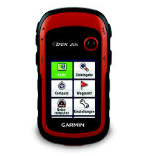
GARMIN GPS eTrex 20x 위성 로케이터
문의하기
안전한 결제
품질 보장
간편 교환 및 반품
배송 가능
Physical & Performance | |
| Physical dimensions | 5.4 x 10.3 x 3.3 cm |
| Display size, WxH | 3.5 x 4.4 cm; 5.6 cm diag |
| Display resolution, WxH | 240 x 320 pixels |
| Display type | 2.2" transflective, 65K colour TFT |
| Weight | 141.7 g with batteries |
| Battery | 2 AA batteries (not included); NiMH or Lithium recommended |
| Battery life | Up to 25 hours |
| Water rating | IPX7 |
| High-sensitivity receiver | |
| Interface | USB |
| Camera | No |
Maps & Memory | |
| Basemap | |
| Preloaded maps | Yes - Garmin TopoActive map of Western Europe |
| Ability to add maps | |
| Built-in memory | 3.7 GB including preloaded maps |
| Accepts data cards | microSD™ card (not included) |
| Custom POIs (ability to add additional points of interest) | |
| Waypoints/favorites/locations | 2000 |
| Routes | 200 |
| Track log | 10,000 points, 200 saved tracks |
Outdoor Features | |
| Automatic routing (turn by turn routing on roads) | Yes (with optional mapping for detailed roads) |
| Geocaching-friendly | Yes (Paperless) |
| Custom maps compatible | |
| Sun and moon information | |
| Tide tables | Yes (with optional Bluechart) |
| Area calculation | |
| Picture viewer | |
Physical & Performance |
|
| Physical dimensions | 5.4 x 10.3 x 3.3 cm |
| Display size, WxH | 3.5 x 4.4 cm; 5.6 cm diag |
| Display resolution, WxH | 240 x 320 pixels |
| Display type | 2.2" transflective, 65K colour TFT |
| Weight | 141.7 g with batteries |
| Battery | 2 AA batteries (not included); NiMH or Lithium recommended |
| Battery life | Up to 25 hours |
| Water rating | IPX7 |
| High-sensitivity receiver | |
| Interface | USB |
| Camera |
No |
Maps & Memory |
|
| Basemap | |
| Preloaded maps |
Yes - Garmin TopoActive map of Western Europe |
| Ability to add maps | |
| Built-in memory | 3.7 GB including preloaded maps |
| Accepts data cards | microSD™ card (not included) |
| Custom POIs (ability to add additional points of interest) | |
| Waypoints/favorites/locations | 2000 |
| Routes | 200 |
| Track log | 10,000 points, 200 saved tracks |
Outdoor Features |
|
| Automatic routing (turn by turn routing on roads) | Yes (with optional mapping for detailed roads) |
| Geocaching-friendly | Yes (Paperless) |
| Custom maps compatible | |
| Sun and moon information | |
| Tide tables | Yes (with optional Bluechart) |
| Area calculation | |
| Picture viewer | |
빠른 지원
인증된 전문가에게 직접 연결